Setting a different Map Scan Radius in Local Falcon allows you to narrow or broaden the search area for your Local Rank Tracking data scans and define the level of data detail you want from your scans.
Local Falcon's Map Scan search area radius can be manipulated using two main parameters: Grid Radius (distance from the center to outer data points) and Grid Size (number of data points on the map).
By changing these parameters, you can see how your business stacks up against the competition in an area as small as just a couple of blocks wide, or as large as 100 miles in all directions.
Changing the Default Map Scan Radius Settings
- Log in to your Local Falcon account
- Go to the Local Falcon homepage and click "Login" in the top right-hand corner, then enter the email address and password you used to create your account.
- Go to "Quick Scan"
- Select "Quick Scan" in the main navigation menu on the left-hand side of the screen.
- Change the Grid Radius (Optional)
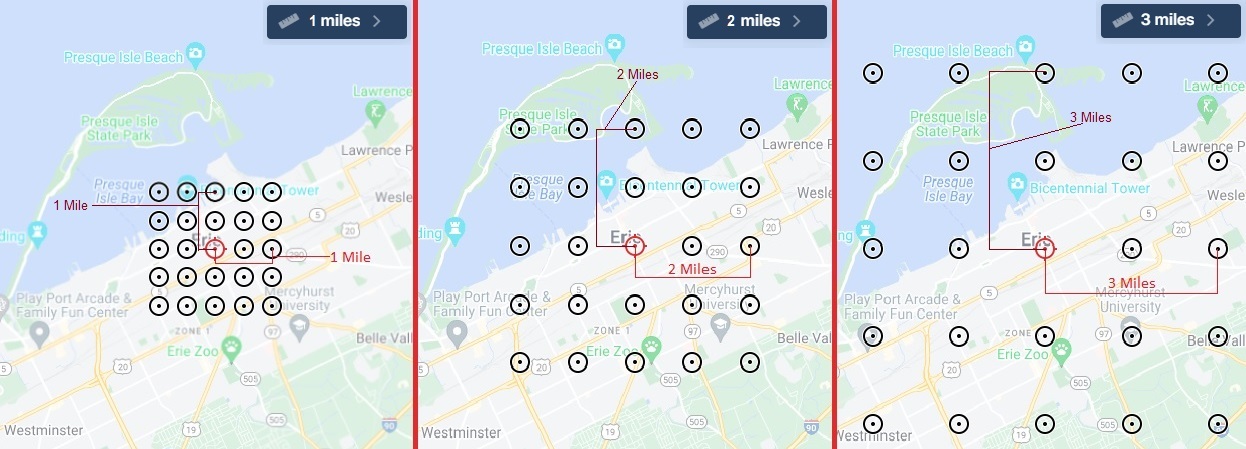
- The default Grid Radius is 1 mile, meaning that the distance from the center data point to the outermost data points (horizontally & vertically) is 1 mile. You can see the distance between individual map pins at the bottom of the map.
- Click the drop-down at the top of the map where it says "1 miles" to see all the Grid Radius options (you can switch between the imperial and metric systems using the drop-down to the right, where it says "Imperial" by default).
- Select a new Grid Radius from 0.1 miles to 100 miles to make your Local Rank Tracking data search area smaller or larger.
- Change the Grid Size (Optional)
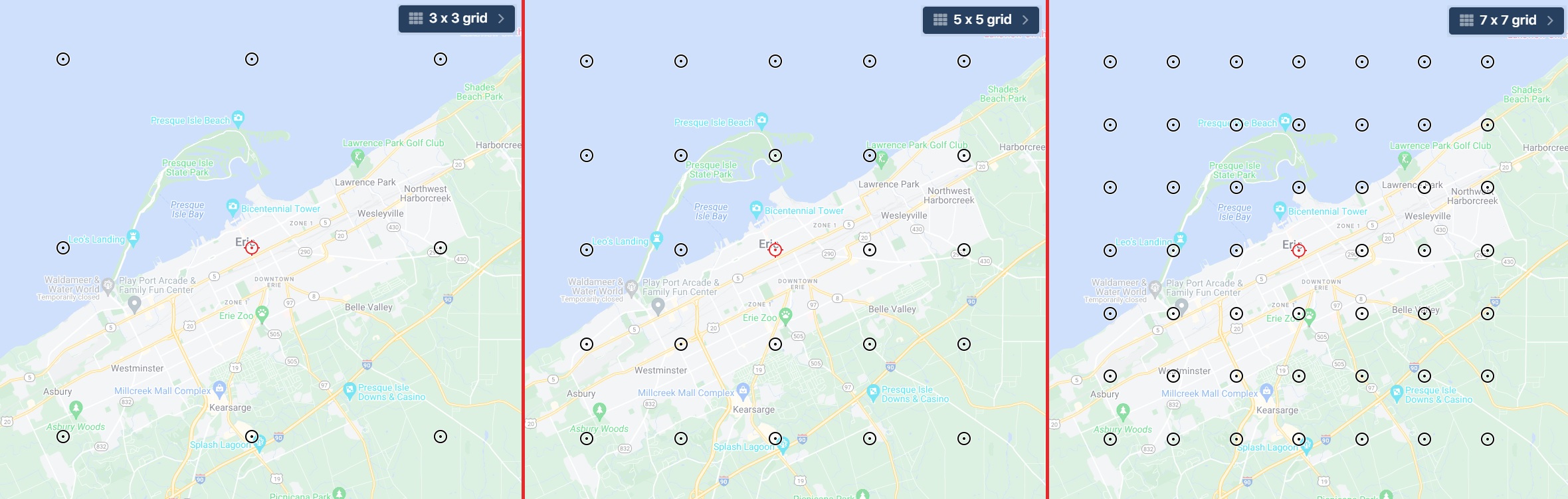
- The lowest Grid Size is 3 x 3, meaning the search area radius grid is 3 data points wide by 3 data points long and has a total of 9 data points.
- Click the drop-down at the top of the map where it says "3 x 3 grid" to see all the different Grid Size options (we offer ten grid sizes: 3x3, 5x5, 7x7, 9x9, 11x11, 13x13, 15x15, 17x17, 19x19 and 21x21).
- Select a new Grid Size from 3 x 3 up to 21 x 21 if you wish to change the number of data points to be used for your Map Scan.
- The more data points you use, the easier it is to see exactly where your search ranking starts to fall off, regardless of the radius distance you set, but keep in mind that each data point uses 1 credit.
- Disable Any Data Points You Don't Want To Use (Optional)
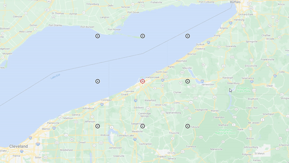
- Click on any data points you do not want to include in your Map Scan to disable them, such as those that are over large bodies of water or other areas that are not relevant (where people are not likely to be doing Google searches).
- An "X" will appear across any data points you have disabled, and you can easily re-enable them with another click.
Category:Map Scan Tool
Tag:scan settings