When you're after precise local rank tracking data, you want to make sure every data point you're using for your Map Scans counts. This is important for two reasons: not all potential data points are relevant and the more data points you use, the more credits each scan costs you!
Although Local Falcon's default geo-grid shape is a square, our Flexible Grid Points allow you to easily create custom grid shapes to suit your local rank tracking reporting needs and budget. This flexibility is available for both individual scans and Campaign Scans. In other words, you can disable unwanted data points for any location included in a Campaign.
Flexible Grid Points are a feature Local Falcon has had basically forever, but not everyone is familiar with exactly how to best use this feature to their advantage. So, we wanted to take a moment to put together this blog post and clear up any doubts you may have about using custom grid shapes for your Local Falcon scans.
What Exactly Are Flexible Grid Points?
When you choose your Scan Settings in Local Falcon, two of the most important settings you can change are the Map Scan Radius and Grid Size.
The radius setting determines the distance from the center grid point (typically the business location) to each outermost grid point, while the size of the grid determines how many grid points there are in total.
Once you've set the Map Scan Radius and Grid Size, you can simply click on any of the data points that appear in the grid to disable them and they won't be used as data points for your upcoming scan.
By disabling certain grid points, you can fully customize the shape of any geo-grid, allowing you to draw local rank tracking insights from only the most relevant data points and maximizing your credit budget.
When Should You Disable Grid Points?
Disabling Grid Points Over Water
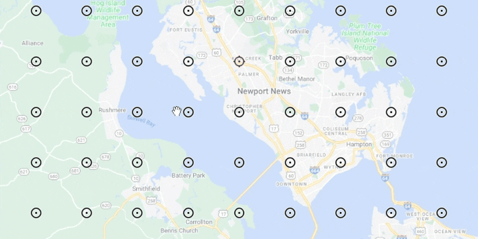
The most common reason you should disable grid points before running a scan in Local Falcon is because there are data points over a body of water.
Local rank tracking data comes from areas where people are actually searching Google for your business and related terms, which is something that's not typically happening from out on the water!
As such, you should make a habit of disabling any and all grid points over water to avoid wasting credits on scanning irrelevant data points. This is especially important for Campaign Scans, as locations can have different geographic features that could potentially skew insights if you just use the same grid shape for all of them.
Disabling Grid Points Because of Different Population Densities
In some cases, you may want to disable certain grid points to avoid scanning areas of your grid where the population density is extremely low, or where there are few to no potential customers.
For example, let's say your business is located on the border of a densely populated urban area and a more rural area with a much lower population (or even something like a large swathe of parkland), and your focus is on selling to customers in the populated urban core.
In this case, you might choose to disable the grid points that go out into the rural areas of the grid to create a custom grid shape that better captures where your target customers are actually located.
Disabling Grid Points To Track Rankings in Different Service Areas
Another reason you might want to disable some of Local Falcon's Flexible Grid Points is to get local rank tracking data about different specific service areas in the same scan, maybe even over quite a large region.
For instance, if you run a service-based business that serves customers in several small towns spread out over a rural region, you could potentially choose a large grid radius and size for the scan to cover all your company's service areas, then disable any grid points in between for areas you don't serve.
That way, you're not spending any credits on scanning spaces between your service areas, but you're getting relevant local rank tracking data from different towns you serve all at once.
Or, let's say you have multiple locations in a Campaign with adjacent service areas that aren't perfect squares. In this case, you could disable overlapping grid points for one location or the other to clearly define service areas and get the most relevant data for each location.
Try Running a Map Scan with a Custom Grid Shape Today!
Local Falcon's flexible grid points are nothing new, but maybe now you've learned a new way to use them that might not have occurred to you before.
So, what are you waiting for? Now's the perfect time to start experimenting with custom grid shapes in your rank tracking scans! The more precise the data points your Map Scans use are, the more insightful your reports will be. Plus your credits will last longer!
If you have any other questions about how to use Local Falcon, make sure to check out our knowledge base and FAQs, as well as the other articles on our blog, where we announce all the new features we're constantly working to put out and cover a range of topics related to Local Falcon and local SEO.